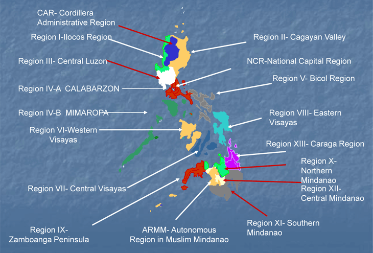
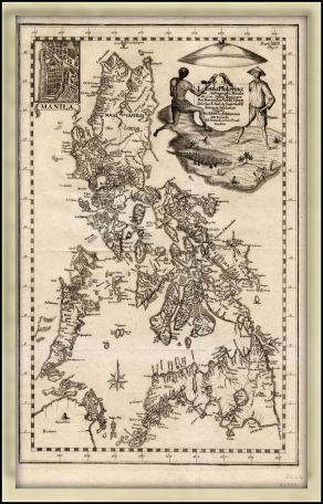
Ibat'-ibang halimbawa ng
Mapa ng Pilipinas

Royalty Free Blank Philippines Printable Map.
Jones, Bruce. 2010. Royalty Free Philippines Printable, Blank Maps. Retrieved from: www.freeusandworldmaps.com
Royalty Free, Printable, Philippines Map with Administrative Districts and names, jpg format. Includes parts of Malaysia, Indonesia, and Brunei. This map can be printed out to make an 8.5 x 11 printable map. Right click mouse and click "Save image as.."
Jones, Bruce. 2010. Royalty Free Philippines Printable, Blank Maps. Retrieved from: www.freeusandworldmaps.com
Plain map of the Philippines, with regional borders. Some of Malaysia is visible too, at the bottom left corner.
Howard the Duck.2008. Retrieved from: commons.wikimedia.org
Royalty Free, Printable, map of the Philippines in color.
Jones, Bruce. 2010. Royalty Free Philippines Printable, Blank Maps. Retrieved from: www.freeusandworldmaps.com
Maso, Miguel Saderra, S.J. 2006. [EBook #18556] Retrieved from: http://www.gutenberg.org/files/18556/18556-h/18556-h.htm
Retrieved from: https://familysearch.org/learn/wiki/en/Philippines_Map_from_Research_Guidance
Retrieved from: http://www.worldofmaps.net/en/asia/map-philippines/map-ethnics-philippines.htm
Different regions, and ethnic groups around the Philippines.
L.L. PO TES Engineers. n.d.. Races and Peoples of the Philippines. Retrieved from: http://fototime.com/5BC9EB84C7FCAC8/orig.jpg

Velarde, Fr. Pedro Murillo. 1734.[Fr. Pedro Murillo Velarde's Map of year 1734] Retrieved from: http://www.zamboanga.net/Arts&CultureZamboangaHistory.htm